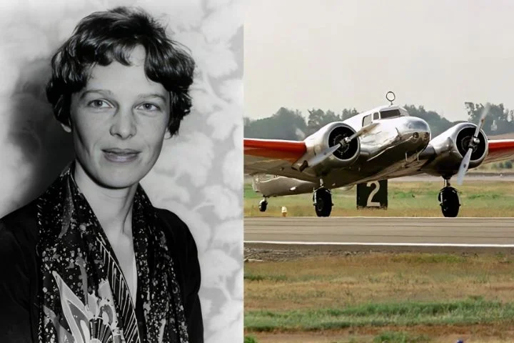
A potential breakthrough in the 87-year-old mystery surrounding Amelia Earhart’s disappearance almost vanished like the trailblazing aviator herself while the adventurers who captured it investigated a 14-year-old theory about what happened on her ill-fated flight.
Deep Sea Vision CEO Tony Romeo and his brother Lloyd released sonar images last week from their $11 million expedition in the Pacific Ocean, which depicted a hazy plane-shaped mass they believe may be Earhart’s Lockheed 10-E Electra.
The brothers, who say they are planning another expedition this year or next to get better pictures of the wreckage, told The Daily Mail the potentially vital images may have never seen the light of day due to hard drive issues they encountered during their 90-day voyage.
The 16-person expedition, funded by the sale of Tony Romeo’s commercial real estate properties, launched in September from Tarawa, Kiribati, a port near Howland Island.
They scanned 5,200 square miles of ocean floor using an underwater drone, whose sonar data had to be retrieved and scanned between runs.
At one point, the hard drives seemed totally corrupted and were set to be wiped and formatted — until the company’s chief of operations discovered the data was retrievable, he said.

That’s when the group’s incredible discovery was made.
“We realized that we had something there — an area that’s very sandy and flat, this immediately stuck out as something that was very likely an aircraft,” Romeo told the Daily Mail.
The brothers said their team’s potentially groundbreaking discovery stemmed from the “Date Line” theory proposed in 2010 by Liz Smith, a former NASA employee and amateur pilot, to explain the disappearance of Earhart and her navigator, Fred Noonan, during what was supposed to be a record-setting voyage around the world in 1937.

The theory posits that as Earhart and Noonan soared across the international dateline, the navigator forgot to turn his calendar back one day, which ultimately sent the pair off course roughly 60 miles.
Romeo, a pilot and former US Air Force intelligence officer, said that while Noonan was an experienced pilot unlikely to make such a mistake, fatigue could have played a role in the grave mistake.
“As we looked at it as pilots, you do get exhausted when you’re flying,” he told the Daily Mail.

The theory led them to coordinates that were roughly 3 miles beneath the ocean’s surface, and within 100 miles of Howland Island, which is where their drone picked up the sonar image of a plane-like figure they believe is the remains of Earhart’s doomed voyage.
Romeo admitted to the outlet that there’s a chance that the sonar image isn’t her plane, but rather the remains from another downed aircraft or even a bizarre rock formation. A follow-up expedition will hopefully confirm their findings — and help resolve the decades-long mystery.
“We need to get a camera on it. When we see those numbers NR16020 on the wing, that’s when we’ll know for sure what it is,” he told the Mail.
On July 2, 1937, Earhart and Noonan set off from Lae, Papua New Guinea, with plans to refuel on Howland Island before continuing their journey to Honolulu and their final destination of Oakland, Calif.
The pair faced a strong headwind in Lae, and were heading toward Howland when Earhart’s radio transmissions eventually went silent.
The US Navy and Coast Guard conducted a 16-day search for the missing duo without success, and Earhart was officially declared de*ad on Jan. 5, 1939.


